The YouTube link below will take you to some ramblings of mine that I started writing after completing the Adventure and realizing that returning home would not be as simple as I thought. The physical and mental progression is probably not unique to my situation but was not anticipated by me. All is good.
"After the Adventure"
Still Paddling,
BeaV
Inside Passage
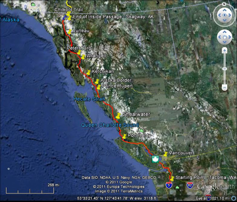
The above map depicts my planned paddle route along the Inside Passage
Yukon/Alaska Overview
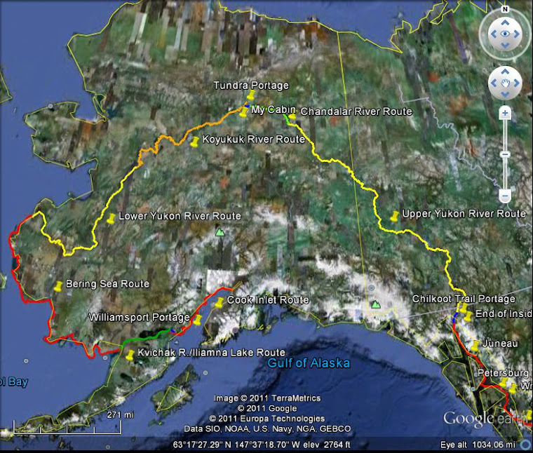
The above map depicts my planned paddle & portage routes through the Yukon Territory and Alaska
Chilkoot Pass

Historical photo of gold rush "Klondikers" (the long black line) climbing toward the Pass
Upper Yukon River

Upper Yukon River
Yukon River
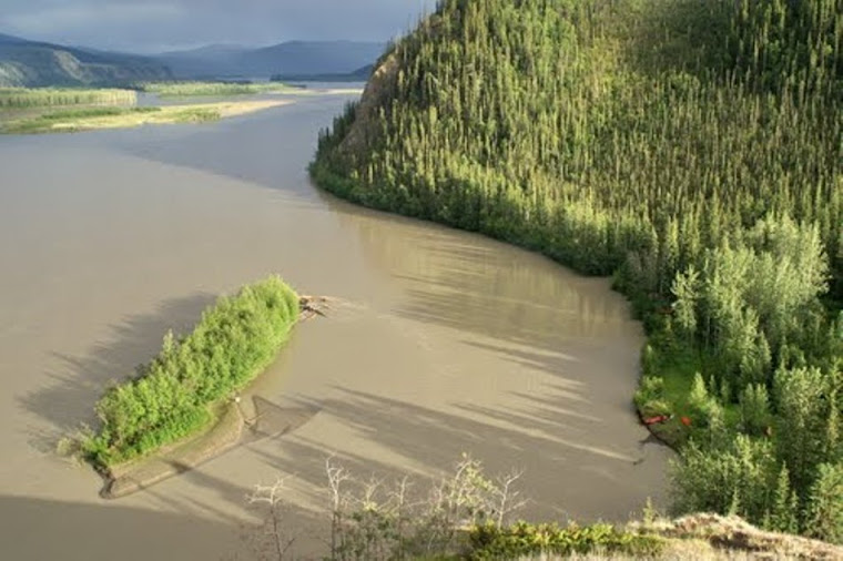
Further Downstream
"The Flats"
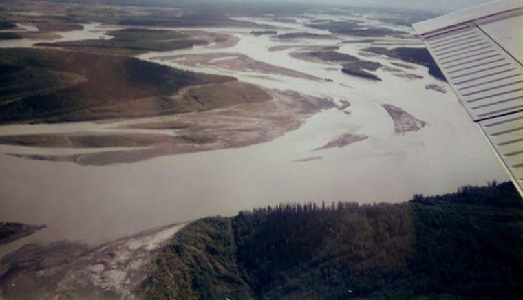
"The Flats"
Chandalar River Picture
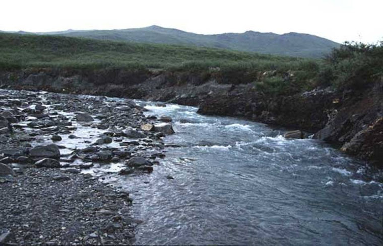
Chandalar River
Koyukuk River

The South Fork of the Koyukuk River. Photo taken from my 1989 trip.
Koyukuk Cabin
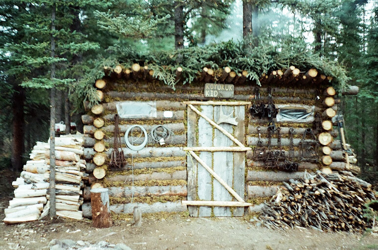
My cabin on the Koyukuk River
Sunday, February 1, 2015

Monday, September 15, 2014
I Made It- 1 Year Look Back
"Determination, persistance, wise decision making, and a little luck will be needed to do the entire route in one season before freezeup."
That was my thought before the Adventure began. Now....I wouldn't change those four things needed to succeed although I'd move "persistence" to the last. It starts with "determination" and ends with "persistence" with "wise decision making and a little luck" needed in between. Yup, that sums er up pretty good!
The Adventure ended 1 year ago today- at least that’s when I
paddled into Anchorage and put the paddle down.
Since then, I have relived parts of the trip over and over again as I’ve
edited my videos and shared those moments with some people near to me. It has been difficult to share the details of
the Adventure partially because of hesitation on my part but also because of
the lack of understanding of many people around me. I suppose a written account (book) would help
but I’m still not going there.
For those interested in reading more, the best written account out there is an internet discussion on an Alaskan Canoeing forum where I posted a question about availability of drinking water on the Bering Sea coastline that turned into kind of a play-by-play of the trip. If you’d like to understand some of challenges faced take a look at that discussion and then maybe you’ll think twice before asking me if “I’d do it again?” It's 32 pages of discussion starting with Post #1 dated 01-03-2013.
Bering-Sea-West-Alaska-Coastline
Being back from the Adventure hasn’t been without its challenges too. But I wouldn’t want to relive the past. Still glad it’s over…but when I see water, I haven’t lost the urge to paddle it.
That was my thought before the Adventure began. Now....I wouldn't change those four things needed to succeed although I'd move "persistence" to the last. It starts with "determination" and ends with "persistence" with "wise decision making and a little luck" needed in between. Yup, that sums er up pretty good!
 |
| Sporting my new replacement hat |
For those interested in reading more, the best written account out there is an internet discussion on an Alaskan Canoeing forum where I posted a question about availability of drinking water on the Bering Sea coastline that turned into kind of a play-by-play of the trip. If you’d like to understand some of challenges faced take a look at that discussion and then maybe you’ll think twice before asking me if “I’d do it again?” It's 32 pages of discussion starting with Post #1 dated 01-03-2013.
Bering-Sea-West-Alaska-Coastline
Being back from the Adventure hasn’t been without its challenges too. But I wouldn’t want to relive the past. Still glad it’s over…but when I see water, I haven’t lost the urge to paddle it.
Monday, September 1, 2014
Character
Hey everyone!
I feel bad that I haven’t updated my Blog since November but
the trip is over and I have no interest in turning this into anything other
than a Blog about the Adventure. As the
one-year anniversary of completion of the trip approaches, I’ve been pondering
some things and looking back at events that happened and people I met along the
way. I decided I need to acknowledge the
“top five” list of people I met along the way that impacted me in a special
way. This list does not include friends
and family. These are people that were
strangers with nothing to gain in helping me but helped me regardless. Their actions speak volumes to their TRUE CHARACTER!
Leon Somme and Shawna Franklin, Orcas Island Washington
Leon and Shawna are fellow adventurer types whose faces lit
up with excitement and understanding when they first heard of my plans. They graciously provided assistance by
offering their place in Washington as a home base for me to start my Adventure
from, instructed me on the basics of paddling in tidal conditions, and welcomed
me into their family for a couple days. They
helped give me confidence at this time filled with doubts and uncertainties of
what lay ahead.
Amigo Will, Wrangell Southeast Alaska
Amigo Will, an internet friend whom I had never met before
and hardly corresponded with, yet somehow he seemed to know me like someone
only knows a person from experiencing tough times together. He was an Alaskan who believed I could. Will and his wife Barbara welcomed me to
their home town with offers of assistance.
Having a friendly face welcome me in a strange place gave me hope that
others would be waiting to greet me along the way.
Grafton, Fort Yukon Interior Alaska
Grafton, a native resident of Fort Yukon, after a brief
meeting on the riverbank, brought a hot supper to my camp, later offered fish
from his net, and watched after me in a somewhat dangerous place for a lone
stranger. While all in the village were
telling me what I was about to attempt on the Chandalar was sure death, Grafton
quietly said to me “those others only know of travel with 100 hp motors, you
might be able to do it”. That was his
way of saying that he believed that I could do it. Yet, at the same time, he
was genuinely worried for my safety. He
seen me off as I left the village, even offering to give his shotgun to me if I
didn’t have one because I was going into bad bear country. The kindness shown to me for reasons unknown
would not be forgotten.
John Rivers, Sr., Quinhagak Bering Sea Coast Alaska
The Village of Quinhagak lays near the end of the dreaded
tidal mud flats that beat me down day after day combined with cold rains,
wind-swept exposed coastline, and the treacherous crossing of the Kuskokwim
River delta all left me feeling like life was me against all. That all changed when I knocked on John’s
door to ask if I could leave my boat on the river bank near his house while I
went into town to call home. John took
charge and said it was not safe to leave my stuff there and had his son help me
stash my gear in his shed. Then he saw
the awful rusty condition my shotgun was in and said he would clean it and get
it working again. Later that day when I
returned to get my stuff and go back out into the nasty rainy weather, John
invited me to stay the night in his house with his family. I almost declined the offer, but faced with
the option of going back out to sea in the brutal weather, accepted. Glad I did as it was awesome to finally be
warm, dry, and sheltered again. John
offered much advice from religion to surviving bear attacks to getting off the
Bering Sea- and I listened. For a short
time, I had somebody on my side!
Stay tuned as I will have a couple more Blog entries in the
near future.
BeaV
Monday, November 25, 2013
Radio Interview
Two days after my arrival in Anchorage, I did a couple of radio interviews with Alaska Public Media. If you'd like to listen to them, click on the link below and scroll down on their web page to find each interview and click on the play button.
Alaska Public Radio Interviews
Alaska Public Radio Interviews
Wednesday, November 6, 2013
Return to Minnesota
I flew back to Anchorage a few days after my niece's wedding only to find out that my ferry was delayed 2 days due to bad winds. No complaints from me as being delayed in Alaska is a good thing. My friend Mark and I used this extra time to charter a halibut fishing trip out of Homer with good results.

The Alaska Ferry ship Kennecott was further delayed due to wind but eventually arrived and I boarded her for a ride to Juneau. Interesting to note that a 400 foot long ship can also be adversely affected by wind/waves as my 17 foot canoe often was. What a nice change of pace to just sit back and enjoy the ride through the Gulf of Alaska. I really enjoyed the ride as the winds picked up to 50 mph gusting to 65 mph for most of a day. The crew told me the captain considered going to port to avoid the wind but ultimately decided to stay out.
The storm delayed our arrival into Juneau causing us to get there around 4 am. I was pleasantly surprised to have someone call my name as I departed the ferry. Local resident, Mike F., had gotten up in the middle of the night to come pick me up at the ferry terminal. I ended up staying with Mike and his wife, Noreen, at their home for a few days while I was waiting for the next ferry to arrive. Mike and Noreen both work for the US Coast Guard and had followed my adventure. I had a great time trading stories and hanging out with them- thanks Mike and Noreen for being such great hosts!
While in Juneau, I wanted to canoe up to a glacier somewhere. The Mendenhall Glacier is close to town so that was my destination only I chose to get there the hard way. Most people drive to Mendenhall Lake and put in there, I decided to do it by paddling from Mike and Noreen's place. I put in at Fritz Cove and paddled to and up the Mendenhall River to get to the lake and then the glacier. The Mendenhall River is really cold (30 something degrees) and has some class 2 whitewater making for a challenging paddle/pull upstream. I made it to the glacier and proceeded to retrace my path back down the river. Although the Kruger Sea Wind canoe is a great expedition canoe, it is not built for whitewater paddling. Yup, I capsized on the approach to the class 2 rapids ending up bouncing my way through part of them. I managed to save the canoe and myself, once again, but did crack and deform the boat's hull.

From Juneau I boarded another ferry headed to Washington State. Much of the route taken by the ship was the same as I had paddled this last spring. Seeing some of the same areas again brought back past memories of both struggle and accomplishment. These areas now observed from the ship's deck perspective differred from before- now it wasn't personal, it was just scenery to be glanced at from far away and lacking of a sense of experience. Sadly, I had become a tourist.

The Alaska Ferry ship Kennecott was further delayed due to wind but eventually arrived and I boarded her for a ride to Juneau. Interesting to note that a 400 foot long ship can also be adversely affected by wind/waves as my 17 foot canoe often was. What a nice change of pace to just sit back and enjoy the ride through the Gulf of Alaska. I really enjoyed the ride as the winds picked up to 50 mph gusting to 65 mph for most of a day. The crew told me the captain considered going to port to avoid the wind but ultimately decided to stay out.
The storm delayed our arrival into Juneau causing us to get there around 4 am. I was pleasantly surprised to have someone call my name as I departed the ferry. Local resident, Mike F., had gotten up in the middle of the night to come pick me up at the ferry terminal. I ended up staying with Mike and his wife, Noreen, at their home for a few days while I was waiting for the next ferry to arrive. Mike and Noreen both work for the US Coast Guard and had followed my adventure. I had a great time trading stories and hanging out with them- thanks Mike and Noreen for being such great hosts!
While in Juneau, I wanted to canoe up to a glacier somewhere. The Mendenhall Glacier is close to town so that was my destination only I chose to get there the hard way. Most people drive to Mendenhall Lake and put in there, I decided to do it by paddling from Mike and Noreen's place. I put in at Fritz Cove and paddled to and up the Mendenhall River to get to the lake and then the glacier. The Mendenhall River is really cold (30 something degrees) and has some class 2 whitewater making for a challenging paddle/pull upstream. I made it to the glacier and proceeded to retrace my path back down the river. Although the Kruger Sea Wind canoe is a great expedition canoe, it is not built for whitewater paddling. Yup, I capsized on the approach to the class 2 rapids ending up bouncing my way through part of them. I managed to save the canoe and myself, once again, but did crack and deform the boat's hull.

From Juneau I boarded another ferry headed to Washington State. Much of the route taken by the ship was the same as I had paddled this last spring. Seeing some of the same areas again brought back past memories of both struggle and accomplishment. These areas now observed from the ship's deck perspective differred from before- now it wasn't personal, it was just scenery to be glanced at from far away and lacking of a sense of experience. Sadly, I had become a tourist.
Wednesday, September 25, 2013
Back in MN Temporarily
I was really excited to make it back to Minnesota in time for my niece Ashley's wedding this past weekend. Ashley and Jeremy were married on the shore of Lake Superior near Lutsen. It was great to see all my immediate family and some friends. The weather was perfect for an outdoor wedding. Here's a photo of the newlyweds and I.

I will be back in Anchorage today to bring my canoe and gear home. I will take the Alaska Ferry from Homer to Juneau, then a week layover in Juneau, and then the ferry to Bellingham, WA.
BeaV

I will be back in Anchorage today to bring my canoe and gear home. I will take the Alaska Ferry from Homer to Juneau, then a week layover in Juneau, and then the ferry to Bellingham, WA.
BeaV
Monday, September 16, 2013
Safe in Anchorage
My final paddle day's plan to reach Anchorage worked out perfect. Low tide was to be at 10:30 am so I launched from my camp at the mouth of the Susitna River an hour and a half before that so I could take advantage of the river current to help push and guide me through the maze of sand tidal flats out to the deeper water of Cook Inlet (about 3 or 4 miles out!). I made it to deep water just as the tide was to go to flood and this would help push me into Anchorage. My marine radio National Weather Service forecast was great- light and variable winds less than 10 mph. You can see from my Mappage that this was the case to begin with and I was cruising straight toward Fire Island. But in the blink of an eye, a strong north wind blew up gusting to 20 or 25 mph and forced me to turn into it and head for the shallows of the tidal flats for protection. A fitting last day challenge, I suppose, since the wind was my nemesis on so many days throughout the Adventure.
After a couple hours, the north wind settled down and things were looking good until I passed Fire Island. Then a southeast wind blowing out of Turnagain Arm came at me broadside. Not bad but whenever you mix waves with strong tidal currents things become dicey. I didn't care at this point because I was in such a great mood as I neared Anchorage.
I paddled up a small creek and landed at a bike trail bridge crossing ending the Adventure. It didn't take long and I had a small group of people asking a ton of questions followed by the appearance of a newspaper reporter. I see the newspaper already did their story last night- here is a link:
http://www.adn.com/2013/09/15/3077485/canoeist-bob-beav-vollhaber.html
Here's the associated news video: http://www.youtube.com/watch?v=wb3Dk9sMi9Q
My old college friend, Mark Robokoff, arrived a couple hours later and we loaded up my canoe and gear, dropped it off at his place, and off to a restaurant for my long awaited victory hamburger meal. I will end the Adventure here and not continue to Juneau (during the planning of the trip, I thought I might add to it and paddle to Juneau).
How do I feel this morning? My last paragraph of my last journal entry sums it up well, "I feel relieved that it's over and I'm alive and well. Thank God. No more will I have to risk my life to the whim of the wind. I am safe. I feel great. I have no regrets".
Bob
After a couple hours, the north wind settled down and things were looking good until I passed Fire Island. Then a southeast wind blowing out of Turnagain Arm came at me broadside. Not bad but whenever you mix waves with strong tidal currents things become dicey. I didn't care at this point because I was in such a great mood as I neared Anchorage.
I paddled up a small creek and landed at a bike trail bridge crossing ending the Adventure. It didn't take long and I had a small group of people asking a ton of questions followed by the appearance of a newspaper reporter. I see the newspaper already did their story last night- here is a link:
http://www.adn.com/2013/09/15/3077485/canoeist-bob-beav-vollhaber.html
Here's the associated news video: http://www.youtube.com/watch?v=wb3Dk9sMi9Q
My old college friend, Mark Robokoff, arrived a couple hours later and we loaded up my canoe and gear, dropped it off at his place, and off to a restaurant for my long awaited victory hamburger meal. I will end the Adventure here and not continue to Juneau (during the planning of the trip, I thought I might add to it and paddle to Juneau).
How do I feel this morning? My last paragraph of my last journal entry sums it up well, "I feel relieved that it's over and I'm alive and well. Thank God. No more will I have to risk my life to the whim of the wind. I am safe. I feel great. I have no regrets".
Bob
The Eagle has Landed
Well, Bob has made it Anchorage! He made it there last night and we are sure he is resting some today and eating a lot of good food! He was greeted by a photographer from the Anchorage Daily News and there are some great pictures of Bob in the article. We hope to hear from him soon and have an update. The link below is to the Anchorage Daily News article about Bob.
http://www.adn.com/2013/09/15/3077485/canoeist-bob-beav-vollhaber.html?fb_comment_id=fbc_1410710315823330_63499_1411238922437136#fd951d10a17cba
Until next time...
Kayla & Cassie
http://www.adn.com/2013/09/15/3077485/canoeist-bob-beav-vollhaber.html?fb_comment_id=fbc_1410710315823330_63499_1411238922437136#fd951d10a17cba
Until next time...
Kayla & Cassie
Wednesday, September 11, 2013
Get me off the Sea
Here is another entry that Bob sent for us to share with you.
Aug. 28th, 2013
Almost there, almost done with the Bering Sea! I can hardly wait to get off of here. This is not a canoe friendly place. I write this from within an abandoned/vacated eskimo home 8 miles from the mouth of the Kvichak River and freedom from the daily difficulties here-wind, waves, tidal flats, and tides. Paddling here requires constant planning as to how to deal with these four things safely while still making good progress.
It's like a game of chess. The wind is the bishop cuz it always comes at me diagonally, the waves are the knights cuz they show up out of nowhere, the tide is the castle cuz they move up and down, and the tidal flats are the queen cuz she can get you from any direction and is the hardest to avoid. I'm just a pawn-once I move, my only choice is to take one step forward.
I'm waiting here until the tide turns to flood and is high enough to float me off the sand tidal flat. Tonight I will be back in the boat heading for the Kvichak River. This pawn is about to make it across the chess board!
BeaV
We are getting very excited that Bob is reaching the end of his adventure and can't wait until he shares all his amazing stories with us! Stay tuned for any news of Bob's arrival in Anchorage and what his next move will be. Until next time...
Kayla & Cassie
Aug. 28th, 2013
Almost there, almost done with the Bering Sea! I can hardly wait to get off of here. This is not a canoe friendly place. I write this from within an abandoned/vacated eskimo home 8 miles from the mouth of the Kvichak River and freedom from the daily difficulties here-wind, waves, tidal flats, and tides. Paddling here requires constant planning as to how to deal with these four things safely while still making good progress.
It's like a game of chess. The wind is the bishop cuz it always comes at me diagonally, the waves are the knights cuz they show up out of nowhere, the tide is the castle cuz they move up and down, and the tidal flats are the queen cuz she can get you from any direction and is the hardest to avoid. I'm just a pawn-once I move, my only choice is to take one step forward.
I'm waiting here until the tide turns to flood and is high enough to float me off the sand tidal flat. Tonight I will be back in the boat heading for the Kvichak River. This pawn is about to make it across the chess board!
BeaV
We are getting very excited that Bob is reaching the end of his adventure and can't wait until he shares all his amazing stories with us! Stay tuned for any news of Bob's arrival in Anchorage and what his next move will be. Until next time...
Kayla & Cassie
Tuesday, September 10, 2013
Almost Got Licked
This blog entry was written by BeaV himself on August 21, 2013. He sent us the letter to share with his followers.
Seemed fairly calm in camp this morning but when I got on the water, I soon learned that was not case. Wind was 20 mph, making for some rough paddling conditions. Wind would be quartering from behind me and staying near shore would help with some protection.
Late in the morning, I approached what's called "Tongue Spit", which is a long sand bar that juts out into Hagemeister Straight about 6 miles. I had 2 choices: 1) stay along shore until I hit the spit and then be pinned there by the wind or 2) cut diagonally from shore crossing the bay to the far point of the spit. Cutting the corner had some risks as now I would be broadside to the waves and way out from shore, but this would allow me to get around the spit and keep on paddling into the afternoon. I chose to cut across, of course!
It was going good until about 3 miles out. The wind and waves continued to worsen. Now the bigger waves were 4 footers with occasional whitecaps. I hate big crossings on the Bering Sea! Made it to the spit after a couple hours of nervous paddling but I was short of the point. So now I'm paralleling the Tongue's shoreline, staying just out from where the waves are breaking and now the waves along here are bigger and steeper plus I'm fighting to make progress as I paddle quartering into them. I was just about to turn the corner at the end of the spit when a rogue wave, bigger than the rest, broke right on top of me. I braced for the impact as the rolling whitewater of the wave hit.. I successfully absorbed it but the wave kept me. It spun me around and accelerated me toward shore. I surfed for a good 30 feet before my bow plunged underwater, flipping me upside down.
At first I couldn't free myself from the canoe because the spray skirt was holding me in. I remember telling myself "you gotta hold your breath." I managed to get my head out for a breath before going under again. This time I pushed the canoe away and freed myself. I quickly grabbed after the canoe as the wind blew us toward shore.
The surf was breaking hard on the beach. As soon as we hit the shore I pulled the water-filled boat 100 feet to shelter around the spit, getting pounded the whole way. I quickly bailed the water out, shot some video, and assessed the damage. The canoe was fine; my back hurt a little; lost my coffeepot, sunglasses, and leather hat. The first 2 I could live without, but the hat was a more serious matter since the wide-brimmed hat kept my head and face protected from the sun and rain. And of course, today was a serious steady rain day. I searched for the hat but was starting to really get cold so I had to leave and paddle to warm-up.
I was relieved to be OK, but paddled the rest of the day, miserable, as cold rain pelted me on the head and water would stream down my face and neck. Paddled another 6 hours in 4 foot seas. I came to a river and decided to end the day and drain water from my gear. The river mouth allowed me to get off the water without going through the breaking waves. I turned the corner into the river and to my surprise, there's three boats tethered together up the river 200 feet!! Two Eskimo's waited as I paddled up to them. They were commercial salmon fishing and used the river as a homebase while away from their village in Togiak. They were amazed to see me-they had never seen someone paddle the Bering Sea before. We talked for a half an hour before they had to go out and empty their nets and head back to Togiak. Before they left, they gave me a silver salmon and warm fleece hat!! Good guys that made a bad day a little better. Tongue Spit didn't "lick me" after all!!
BeaV
- So here's a little glimpse into what was probably one of Bob's worst days of the trip! Stay tuned because we have another entry written directly from BeaV to be posted shortly! Again, we want to thank all of Bob's supporters and followers as he nears the end of this amazing adventure! Until next time...
Cassie & Kayla
Seemed fairly calm in camp this morning but when I got on the water, I soon learned that was not case. Wind was 20 mph, making for some rough paddling conditions. Wind would be quartering from behind me and staying near shore would help with some protection.
Late in the morning, I approached what's called "Tongue Spit", which is a long sand bar that juts out into Hagemeister Straight about 6 miles. I had 2 choices: 1) stay along shore until I hit the spit and then be pinned there by the wind or 2) cut diagonally from shore crossing the bay to the far point of the spit. Cutting the corner had some risks as now I would be broadside to the waves and way out from shore, but this would allow me to get around the spit and keep on paddling into the afternoon. I chose to cut across, of course!
It was going good until about 3 miles out. The wind and waves continued to worsen. Now the bigger waves were 4 footers with occasional whitecaps. I hate big crossings on the Bering Sea! Made it to the spit after a couple hours of nervous paddling but I was short of the point. So now I'm paralleling the Tongue's shoreline, staying just out from where the waves are breaking and now the waves along here are bigger and steeper plus I'm fighting to make progress as I paddle quartering into them. I was just about to turn the corner at the end of the spit when a rogue wave, bigger than the rest, broke right on top of me. I braced for the impact as the rolling whitewater of the wave hit.. I successfully absorbed it but the wave kept me. It spun me around and accelerated me toward shore. I surfed for a good 30 feet before my bow plunged underwater, flipping me upside down.
At first I couldn't free myself from the canoe because the spray skirt was holding me in. I remember telling myself "you gotta hold your breath." I managed to get my head out for a breath before going under again. This time I pushed the canoe away and freed myself. I quickly grabbed after the canoe as the wind blew us toward shore.
The surf was breaking hard on the beach. As soon as we hit the shore I pulled the water-filled boat 100 feet to shelter around the spit, getting pounded the whole way. I quickly bailed the water out, shot some video, and assessed the damage. The canoe was fine; my back hurt a little; lost my coffeepot, sunglasses, and leather hat. The first 2 I could live without, but the hat was a more serious matter since the wide-brimmed hat kept my head and face protected from the sun and rain. And of course, today was a serious steady rain day. I searched for the hat but was starting to really get cold so I had to leave and paddle to warm-up.
I was relieved to be OK, but paddled the rest of the day, miserable, as cold rain pelted me on the head and water would stream down my face and neck. Paddled another 6 hours in 4 foot seas. I came to a river and decided to end the day and drain water from my gear. The river mouth allowed me to get off the water without going through the breaking waves. I turned the corner into the river and to my surprise, there's three boats tethered together up the river 200 feet!! Two Eskimo's waited as I paddled up to them. They were commercial salmon fishing and used the river as a homebase while away from their village in Togiak. They were amazed to see me-they had never seen someone paddle the Bering Sea before. We talked for a half an hour before they had to go out and empty their nets and head back to Togiak. Before they left, they gave me a silver salmon and warm fleece hat!! Good guys that made a bad day a little better. Tongue Spit didn't "lick me" after all!!
BeaV
- So here's a little glimpse into what was probably one of Bob's worst days of the trip! Stay tuned because we have another entry written directly from BeaV to be posted shortly! Again, we want to thank all of Bob's supporters and followers as he nears the end of this amazing adventure! Until next time...
Cassie & Kayla
Monday, August 19, 2013
Birds and Beards in the Bering Sea


Well, we are happy to say we have heard from Bob! He was able to call his dad and one of his brothers last week as well as send us an SD card with pictures and a letter. He is doing well and is in good spirits. He has been battling the Bering Sea tidal mud flats (you can see them in the last 3 pictures) which have been a difficult obstacle. Thankfully by now he should be through the mud flats. While traveling through the flats, finding water was also an obstacle since the water was not drinkable. He had to get most of his drinking water from rain water, which he has been getting a lot of since the weather has been cloudy and rainy lately.
Bob told us in his letter that the Bering Sea is not canoe country and the fishermen/seal hunters he has been meeting can't believe he is paddling the coast. But as we know, Bob seems to like challenges and will make it through this one just like he has all the others he has encountered during his trip.
Now, let us explain the pictures above.
1.) For those of you who know Bob, he is almost unrecognizable with his bushy beard! He said there aren't any barbers in the villages so he is just letting his hair and beard grow! Even through that bushy beard, it's great to see his smile that shows he really is having a great time!
2/3.) This is an arctic loon that Bob rescued from a salmon net. Bob said that after he cut the loon free, it rode on his leg in the canoe for a half an hour! We're sure Bob loved having the company!
4,5,&6.) These pictures show how much mud Bob had to deal with while paddling through the flats.
This is what his camp looked like while he was traveling along the mud flats.
As you can see from the pictures, Bob continues to see more wildlife as he travels along the coast. To add to his list of wildlife he has spotted along the way, he saw a herd of muskox, seals, and walruses. Bob is more determined than ever to paddle harder and we know if anyone can finish this adventure, it's Bob. He knows he has many followers and supporters which are helping him when he needs the strength to keep going and to "paddle harder". We hope to hear from Bob soon as he is nearing the end of this amazing adventure!
Until next time.....
Kayla & Cassie
Wednesday, August 14, 2013
Bob & the Bering Sea
We haven't heard from Bob for a while or received any packages, but it looks like he is doing well on the Bering Sea. It looks like the conditions have been pretty good and he has been making good time even though he has been delayed due to weather a couple days. We did get news from a fellow paddler that met Bob on the Yukon River. He met Bob towards the end of the Yukon River and they paddled together for three days. He said Bob was in great shape and good spirits, and I bet Bob was happy to have company for a few days. Thanks for the information Austin! Bob landed in Quinhagak, AK this afternoon so we are hoping to hear from him. Until next time...
Kayla & Cassie
Kayla & Cassie
Thursday, July 25, 2013
More Videos
Well, Bob has been doing a great job of keeping us updated through his videos. We are still sorting through the videos, but so far, there has been a lot of great footage about his adventure. We received another SD card in the mail yesterday so we have plenty of videos to upload for everyone to see. There are two more videos below. In one video Bob shows us the terrain on the river and another he shows us the village of Eagle, even though it's not what he was expecting! It sounds like Bob's luck has been getting better and he is making good progress. He has recovered from the stomach flu and it looks like the only thing that bothers him is the mosquitoes. We hope things keep going smooth and stays healthy! Until next time..
Kayla & Cassie
Kayla & Cassie
Monday, July 22, 2013
Videos
Well, we finally found a tech-savy person to get the videos off the SD cards Bob sent to us. (Thanks Tom!) It was great to see all the videos Bob had made for us to tell all his stories, but hearing Bob's voice and seeing him through the video made us realize how much we really miss him. Bob's videos show that he has had a lot of ups and downs throughout his adventure but is as determined as ever to finish on time. There have been times of frustration, loneliness, and fear, along with times of joy, sillinjess, and pride in what he has accomplished so far. We are all so proud of what Bob has accomplished so far and while Bob may have times of doubt, we are sure he is giving it his all and will fulfill his dreams and inspire others. Throughout the videos you will be able to see that Bob is very humbled to be traveling the same path as so many pioneers from the Klondike Gold Rush and really staying true to his "unsupported" adventure.
We are trying to sort through all the videos, so more videos will be added throughout the week. We are uploading the oldest ones first and will progress with newer ones as the week goes on. Hope you enjoy watching them as much as we did! Until next time....
Cassie & Kayla
http://www.youtube.com/watch?v=FvuqUR-CLXQ&feature=youtu.be
http://www.youtube.com/watch?v=zQCONP25HYE&feature=youtu.be
We are trying to sort through all the videos, so more videos will be added throughout the week. We are uploading the oldest ones first and will progress with newer ones as the week goes on. Hope you enjoy watching them as much as we did! Until next time....
Cassie & Kayla
http://www.youtube.com/watch?v=zQCONP25HYE&feature=youtu.be
Tuesday, July 16, 2013
Letters from Bob
We have finally heard from Bob! We received a long letter from him yesterday along with another SD card full of pictures. We are working on creating a folder so everyone can see the pictures.
Although it was great to hear from Bob again, the news wasn't so good. He has been having a lot of bad luck and he said this leg of the trip has been the toughest so far - even worse than the Chilkoot Pass.
While in Fort Yukon, Bob talked to at least a dozen people about the Chandalar River and they ALL said it was impossible to paddle by canoe and too dangerous even for people with motor boats. They almost had Bob convinced that he shouldn't test his luck and play it safe and just stay on the Yukon River, but Bob knew he had to at least try. His first day on the Chandalar River went well, the second day he wasn't so lucky. The gradient kept getting steeper and steeper and the river was loaded with "sweepers." On day 3 on the Chandalar River, Bob's canoe capsized. Bob is very thankful that he managed to save his canoe, but he did lose his push pole, bear spray, bug head net, and wrecked the battery pack from his solar panel.
Going up the West Fork was extremely difficult and at times Bob had to portage and pull his canoe up the dry, rocky stream bed. Bob was very excited to reach the South Fork and get to see the cabin he built when he was in Alaska in 1989. He was very disappointed to find that the cabin had been burned down. He said it looked like his cabin and site had been used often, probably by moose hunters. At least his outhouse was still standing!
By the time Bob started paddling again, he was very low on food. He had been rationing his food for about a week and only had suppers remaining. He made it to the Haul Rd. and was able to get some food from travelers/campers to tide him over until he could pick up his food packages. Unfortunately he also got the stomach flu from one of these travelers, and spent a few days recovering from that. Feeling "icky" and weak, Bob continued paddling so he could make it to Allakaket to pick up his food packages. His next stop will be St. Mary's to pick up more food and hopefully rest up a little.
We think of Bob everyday and hope he is healthy and happy. We are counting down the days until we hear from him again! Until next time....
Cassie & Kayla
Friday, June 14, 2013
Paddled To Alaska (Again)
This posting is from BeaV
On June 10th I paddled TO Alaska for the second time on this Adventure! If your following me on my MapShare Tracking page you need to subtract 3 hours from what you see on the map (Central Time zone) to get to my time here in Alaska. The only difference I see between Canada and Alaska is the change in the flag. The people I've met along the way have been equally good folks. I also befriended a german and a frenchman while in Whitehorse. Matt (my french friend) and I spent an hour sharing camp on the Yukon just before the huge Lake LaBarge. Matt- I hope your solo kayaking trip to Dawson went well. I felt bad leaving you alone in camp that night as I paddled away at 9:00 pm but Lake LaBarge was calling for me. Evenings alone in camp are the lonliest time of the day as you reflect on the days events but have noone to share them with. Mornings are the best because it's a new day w/new adventures ahead.
Traveling the Upper Yukon River has not been as "easy" as my high speed and long distances covered indicate. If it wasn't for the strong river currents, there would have been days that I would have been windbound on shore. Somehow, I must have angered the wind gods because I continue to have to fight strong headwinds. On this stretch of water I've had 1 hour of wind on my back and 50 in my face. Wind can really become strong as it's funneled up the Yukon River valley. Sometimes winds up to 35 mph blasted me. The wind gods tested my resolve and I said "Ahh, what the hecks going on!", put more power into the paddle, and glanced sideways toward the river bank to make sure I was moving forward. I made it to Fort Yukon.
Flood damage has continued to worsen as I paddled into Eagle and Circle, AK. Both villages had major flooding and ice damage in town with waters that rose 20+ feet. Fort Yukon was lucky and was mostly spared from damage. Though, I hear downriver (Galena) was also damaged badly.
Hoping for tailwinds, BeaV
On June 10th I paddled TO Alaska for the second time on this Adventure! If your following me on my MapShare Tracking page you need to subtract 3 hours from what you see on the map (Central Time zone) to get to my time here in Alaska. The only difference I see between Canada and Alaska is the change in the flag. The people I've met along the way have been equally good folks. I also befriended a german and a frenchman while in Whitehorse. Matt (my french friend) and I spent an hour sharing camp on the Yukon just before the huge Lake LaBarge. Matt- I hope your solo kayaking trip to Dawson went well. I felt bad leaving you alone in camp that night as I paddled away at 9:00 pm but Lake LaBarge was calling for me. Evenings alone in camp are the lonliest time of the day as you reflect on the days events but have noone to share them with. Mornings are the best because it's a new day w/new adventures ahead.
Traveling the Upper Yukon River has not been as "easy" as my high speed and long distances covered indicate. If it wasn't for the strong river currents, there would have been days that I would have been windbound on shore. Somehow, I must have angered the wind gods because I continue to have to fight strong headwinds. On this stretch of water I've had 1 hour of wind on my back and 50 in my face. Wind can really become strong as it's funneled up the Yukon River valley. Sometimes winds up to 35 mph blasted me. The wind gods tested my resolve and I said "Ahh, what the hecks going on!", put more power into the paddle, and glanced sideways toward the river bank to make sure I was moving forward. I made it to Fort Yukon.
Flood damage has continued to worsen as I paddled into Eagle and Circle, AK. Both villages had major flooding and ice damage in town with waters that rose 20+ feet. Fort Yukon was lucky and was mostly spared from damage. Though, I hear downriver (Galena) was also damaged badly.
Hoping for tailwinds, BeaV
Monday, June 10, 2013
There's Gold in Dawson
This posting is by BeaV
Made it to Dawson City in 5 days after leaving Whitehorse. Thanks to Kanoe People for their help (I'd canoe with Scott McDougall anytime). The Yukon River has grown quickly into the largest river I've ever seen as it now varies from 600-2000 feet wide and flowing fast at 5-8 mph with a huge amount of sediment. This sediment makes a fizzing sound like carbonated drinks as it scrapes my canoe hull. The ice out this winter has caused huge amounts of damage to the river banks, islands, and trees as high up as 6' up the banks. At the same time, you can see how the river is creating new islands. The river is running high just above it's banks right now making landing a bit tricky.
After setting up camp and making some canoe repairs, I was set to go to town last night at 9:00 pm to make a "claim" (not a gold claim but a "not dehydrated" meal claim). While waiting to cross the Yukon at the ferry crossing, a local informed me that just like in 1898, I was too late arriving to strike it rich because all the good gold bearing creeks are claimed. Oh well, guess I'll move on. So this ends my tracing the footsteps of the Stampeder's historic route.
I will be reentering Alaska soon and headed for the Chandalar River. That feeling I had in Skagway and couldn't quite define has come back again. I know now what that feeling is- it's a sense of foreboding of what lies ahead. Going upriver on the Chandalar followed by the portage across the tundra concerns me- not sure if it's even possible to do w/only one way to find out!
It's a race now to the Bering Sea to get there before the autumn storms start brewing. My itinerary has me arriving at the mouth of the Yukon/Bering Sea July 26th. The late spring has me already behind schedule by 7 days coming off the Chilkoot and my crazy itinerary doesn't leave any opportunities to make up time. When I originally developed my itinerary, it came out that I would be at the Bering Sea October 1st. That wouldn't work so I made the schedule fit the Bering Sea's and came up with the Adventure's theme of "Paddle Harder".
No time to post any pictures today as the "race is on" and I gotta get back in the canoe and paddle harder.
BeaV
Made it to Dawson City in 5 days after leaving Whitehorse. Thanks to Kanoe People for their help (I'd canoe with Scott McDougall anytime). The Yukon River has grown quickly into the largest river I've ever seen as it now varies from 600-2000 feet wide and flowing fast at 5-8 mph with a huge amount of sediment. This sediment makes a fizzing sound like carbonated drinks as it scrapes my canoe hull. The ice out this winter has caused huge amounts of damage to the river banks, islands, and trees as high up as 6' up the banks. At the same time, you can see how the river is creating new islands. The river is running high just above it's banks right now making landing a bit tricky.
After setting up camp and making some canoe repairs, I was set to go to town last night at 9:00 pm to make a "claim" (not a gold claim but a "not dehydrated" meal claim). While waiting to cross the Yukon at the ferry crossing, a local informed me that just like in 1898, I was too late arriving to strike it rich because all the good gold bearing creeks are claimed. Oh well, guess I'll move on. So this ends my tracing the footsteps of the Stampeder's historic route.
I will be reentering Alaska soon and headed for the Chandalar River. That feeling I had in Skagway and couldn't quite define has come back again. I know now what that feeling is- it's a sense of foreboding of what lies ahead. Going upriver on the Chandalar followed by the portage across the tundra concerns me- not sure if it's even possible to do w/only one way to find out!
It's a race now to the Bering Sea to get there before the autumn storms start brewing. My itinerary has me arriving at the mouth of the Yukon/Bering Sea July 26th. The late spring has me already behind schedule by 7 days coming off the Chilkoot and my crazy itinerary doesn't leave any opportunities to make up time. When I originally developed my itinerary, it came out that I would be at the Bering Sea October 1st. That wouldn't work so I made the schedule fit the Bering Sea's and came up with the Adventure's theme of "Paddle Harder".
No time to post any pictures today as the "race is on" and I gotta get back in the canoe and paddle harder.
BeaV
Monday, June 3, 2013
"The Meanest 33 Miles in the World"
This post is from BeaV live and well in Whitehorse, Yukon.
That title is a quote from one of the original Stampeders that I now fully understand. I carried 250 pounds of gear which included my 17'-3" canoe across the Chilkoot Trail to Lake Bennett. I ended up with three carries to leap frog my outfit across most of the way. Had to go with 4 carries for the steepest part to the summit, though. This was physically the most GRUELING 12 days of my life!
Encountered deep snow from Sheep Camp to Deep Camp (12 miles) so there was no trail to follow. It was more like winter mountaineering through this stretch and I was the first of the season to go over the summit. Took a couple poor routes and had to backtrack and find a better way. Avalanche possibilities were real so I kept that in mind as I chose a route. Had a couple slush slides come down the slopes too near.
I paddled and lined the canoe where I could (Taiya River and Lindeman Lake), dragged it like a sled when it was too windy to shoulder and also across frozen Crater Lake, but mostly carried it on my shoulders. I even carried it going up the final 45 degree slope (the Golden Staircase) to the summit. My canoe paddle became a hiking staff and then a snow ax when climbing. Used climbing crampons and/or snowshoes more than I liked. Snow was very wet spring snow and temperatures were hot never getter below freezing at night. Here are the portage stat's for my Chilkoot crossing starting at Skagway:
Paddled Taiya Inlet & River(twice) and Lindeman Lake: 40 miles
Lined Taiya River: 5 miles
Portaged Trail Length: 141 miles (82 of which were with load)
Climbed Elevation Gain: 18,000 vertical feet (based on park info which I think underestimates the up and downs along the way)
Did I mention it was GRUELING? Yes I did and yes it was! I came to appreciate what the Stampeders of 1897/98 went through in chasing their dreams. Those 30,000 people who made it over the Pass and onto Lake Bennett have my deepest respect.
According to Christine with Parks Canada, the ice came off Bennett just 2 days prior to my arrival. The ice came off Marsh Lake a 1.5 days before my arrival and now I've heard the ice is broken up enough on Lake Labarge for me to get through- I'll find out tomorrow. I'm on the move and feeling good.
That title is a quote from one of the original Stampeders that I now fully understand. I carried 250 pounds of gear which included my 17'-3" canoe across the Chilkoot Trail to Lake Bennett. I ended up with three carries to leap frog my outfit across most of the way. Had to go with 4 carries for the steepest part to the summit, though. This was physically the most GRUELING 12 days of my life!
Encountered deep snow from Sheep Camp to Deep Camp (12 miles) so there was no trail to follow. It was more like winter mountaineering through this stretch and I was the first of the season to go over the summit. Took a couple poor routes and had to backtrack and find a better way. Avalanche possibilities were real so I kept that in mind as I chose a route. Had a couple slush slides come down the slopes too near.
I paddled and lined the canoe where I could (Taiya River and Lindeman Lake), dragged it like a sled when it was too windy to shoulder and also across frozen Crater Lake, but mostly carried it on my shoulders. I even carried it going up the final 45 degree slope (the Golden Staircase) to the summit. My canoe paddle became a hiking staff and then a snow ax when climbing. Used climbing crampons and/or snowshoes more than I liked. Snow was very wet spring snow and temperatures were hot never getter below freezing at night. Here are the portage stat's for my Chilkoot crossing starting at Skagway:
Paddled Taiya Inlet & River(twice) and Lindeman Lake: 40 miles
Lined Taiya River: 5 miles
Portaged Trail Length: 141 miles (82 of which were with load)
Climbed Elevation Gain: 18,000 vertical feet (based on park info which I think underestimates the up and downs along the way)
Did I mention it was GRUELING? Yes I did and yes it was! I came to appreciate what the Stampeders of 1897/98 went through in chasing their dreams. Those 30,000 people who made it over the Pass and onto Lake Bennett have my deepest respect.
 |
| "Sheep Camp, just below snowline" |
 |
| "approach to the pass" |
 |
| "top of the pass looking back the way I just came" |
 |
| "Parks Canada warming shelter at the summit" |
 |
| "celebratory cigar and drink bought by friend in Skagway" |
 |
| "coming down off the summit, standing on Crater Lake" |
 | |
| "Happy Camp camp, treacherous ice/water jam ahead" |
 |
| "end of trail-Bennett Lake and open water once again" |
Tuesday, May 28, 2013
What Goes Up, Must Come Down
Well, Bob is on his way again, so the updates will be coming from Kayla and Cassie. Bob has been able to keep close contact with us because he was able to fix his GPS while he was stuck in Skagway. He left for the Chilkoot Pass on Monday May 20th, and has made great progress. He has cleared the summit of the pass and stayed in camp for a day for some R & R. He hiked shorter lengths as he made his way up the pass so he could keep most of his gear within a close distance. Bob has told us that he is feeling a connection to the history of the Chilkoot Pass. He feels like he is one of the "Klondikers" working the gold rush. He says there are amazing views on the top of the pass and there's tons of snow left. We hope his travels going down the pass go as well as his travels going up. We hope to hear from Bob soon with some more interesting and exciting stories! Until next time....
Kayla & Cassie
Kayla & Cassie
Friday, May 17, 2013
Plan "C" Stands for Chilkoot
This posting is from BeaV in person
Time to be moving again! Spring is progressing in the lower elevations surrounding Skagway. Lower Dewey Lake @ 500' msl has opened up. Every evening as I'm dining at the Harbor House restaurant, Istare glare at the high mountains so intently as to assist w/the melt. Must be working as I'm seeing more exposed rock daily. Tourists at adjoining tables are talking about "how pretty the high mountains look", but that's not what I'm thinking. Can't explain the feeling with words yet, but it seems so "temporary" or "unimaginable" to be sitting in this restaurant on the warm side of the window glass, looking up toward the towering peaks while the waitress lights a candle at my table for ambiance. In just a few days things may be turned 180 degrees as I struggle to build a snow cave for shelter. I may need to light my candle for survival now instead. Maybe then I'll look back toward Skagway and understand what the words should be?
Monday morning as high tide approaches (9:00 am AK time or noon Central), I will paddle to the end of Taiya Inlet to the mouth of the Taiya River and then paddle/pull my canoe up the river hopefully a distance of about 10 miles. I've already been up the river 6 miles so I'm hoping to go a little further. I'd rather struggle by paddle now than walk as I've already blistered my feet from practise portages near town. From there I'll work my way up and over the pass by foot with a better understanding now of what the Stampeders did in 1898 (I love the historic picture above as the Stampeders labored to get over the Pass).
Trying to get chubby in Skagway and hoping for open water ahead,
BeaV

Time to be moving again! Spring is progressing in the lower elevations surrounding Skagway. Lower Dewey Lake @ 500' msl has opened up. Every evening as I'm dining at the Harbor House restaurant, I
Monday morning as high tide approaches (9:00 am AK time or noon Central), I will paddle to the end of Taiya Inlet to the mouth of the Taiya River and then paddle/pull my canoe up the river hopefully a distance of about 10 miles. I've already been up the river 6 miles so I'm hoping to go a little further. I'd rather struggle by paddle now than walk as I've already blistered my feet from practise portages near town. From there I'll work my way up and over the pass by foot with a better understanding now of what the Stampeders did in 1898 (I love the historic picture above as the Stampeders labored to get over the Pass).
Trying to get chubby in Skagway and hoping for open water ahead,
BeaV

Subscribe to:
Posts (Atom)